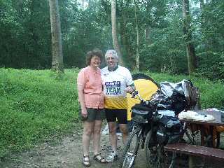
Rick and Charlotte at Killiansburg Cave Campsite |
Day 3: Although the overnight temperatures were slightly on the warm side, I slept pretty well until about 4 a.m. It was at this time when I was awoken by three owls who decided to have a massive hooting party in the tree right over my tent. Eventually, they moved up river, thus allowing me a few hours more sleep.
Once I finally did wake up, I had some breakfast with Rick and Charlotte. I then broke camp, said my farewells, and then headed off to Snyder's Landing Boat Ramp just 1 mile upstream. Here, I left the towpath via Snyder's Landing Road, and headed into Sharpsburg, Maryland for resupply and a quick tour of the Antietam battlefield. I returned to the towpath by the same way I came, and then continued upriver.
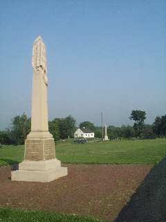
A Monument at Antietam National Battleground |
At mile 82.5, I stopped at the Big Woods campground. The previous day, Charlotte suspected that she left her biking gloves at this campground during a water stop. I had hoped to find them so that can mail them back to her. Unfortunately, they were nowhere to be found, so I pushed on.
The next section is an area known as big slack water. There's often a lot of interest in this section as cyclists are required to take a 4 mile on-road detour. I actually enjoy the detour, but I often get inquiries about options of avoiding the detour. So I decided to do some exploration and continued past the detour into the Dam Number for Recreational Area.
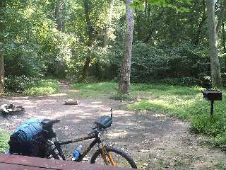
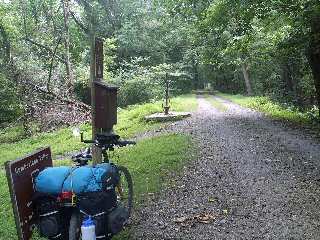
Mile 82.5 - Big Woods Campground |
While on the detour, I made a side trip into Downsville. Here, I stopped at the general store to satisfy my caffeine addiction, and then continued on the detour. Upon returning to the towpath at mile 88, it became obvious why the detour is in place. Along this section, the canal builders decided to circumvent the cliffs along the Maryland side by damning the river and thus creating a slack water section.
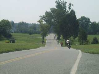
A group of Boy Scouts on the detour |
By 11 o'clock, it had become brutally hot and muggy. The weather report predicted a strong cold front to come through in the late afternoon and evening, so I knew there would be a good chance for heavy rain and severe weather. With the prospects of a muddy towpath looming, I decided my best option would be to try and get as far up river as possible before the storms hit. So I pulled out the cell phone and moved my hotel reservation from Williamsport to Hancock.
Mile 95.2 - A brief stop at Cumberland Valley Campground |
Around 1 p.m., I arrived at Williamsport absolutely drenched with sweat. So I headed to the local air-conditioned pizza parlor, where I devoured a pizza and chilled out for about an hour. After recharging, I went outside to discover that my bike had a flat tire. So I crossed the street to find a shady spot on the sidewalk and began to work on the tube. Immediately after completing the tire repair, my rear derailer cable decided to snap! Unfortunately, I had not prepared for this contingency. The nearest bike shop was 24 miles up river at Hancock, so I decided to push on with my bike stuck in eighth gear. On the way out of town, I made a brief stop at the visitor center so that I could finally learn the correct pronunciation of the word "Conococheague".
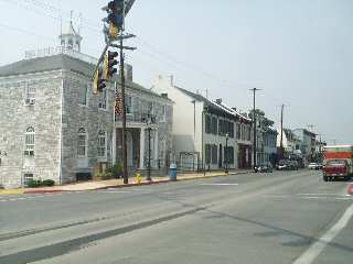
Mile 100 - Downtown Williamsport, MD |
It was a bit tough going with my rear derailer out of service, especially with the rather large climb at four locks, but I managed to continue making good time. Unfortunately by time I reached Big Pool, it was obvious the cold front was coming through sooner than I expected. The skies quickly darkened and the wind frantically whipped up into a frenzy. Just before the downpour hit, a huge branch fell just a few feet ahead of me. Shelter was nowhere to be found, so I quickly pulled out my ground tarp, pulled it over myself and my bicycle, and crouched down in the middle of the towpath.
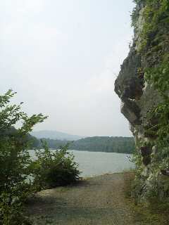
Nice view just upriver from Wiliamsport |
I finally pulled in the Hancock around 6:30 p.m. Luckily, the bike shop was still open, so I was able to get a new derailer cable. The shop normally close at six, but it just so happened that they remained open late to help out a pair of cyclists up river with a broken bike trailer.
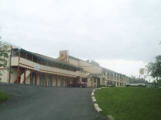
Mile 124 - The Super 8 at Hancock, MD |
Normally, I would not consider this super eight motel as a popular tourist destination. However, after spending a night in a tent, this place was like the Ritz. I took a wonderful shower, put on some clean clothes, and then walked down to the local Sheetz to get a sub for dinner. I ate in the room, and spent the rainy night sound asleep in my bed.