Map of North Central Rock Creek Trail in Maryland |
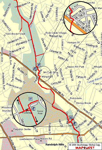
This section is notorious for getting people lost. The top half of this section is actually pretty nice (except for the annoying drainage channels cut across the path). The trail then abruptly ends in a parking area next to a soccer field. From here, it continues on some neighborhood streets and crosses Veirs Mill Rd at the Aspen Hill intersection (see top detail).
About a mile past this intersection is a real nasty little hill (The guys at work call it the Matterhorn!). At the other side of the hill, the the trail comes to a tee with a footbridge to your left (see lower detail). Cross the bridge and bear to the right to remain on the main trail.
People heading north on the trail often miss the turn about a quarter mile past the Randolph Road crossing. There is a soccer field here on your right. Be sure to make the left turn over the foot bridge. This is followed by a quick right and the long climb up the hill (see lower detail).