The 2003 trip was so much fun, I decided to hit the trail again for 2004. This time around I would be spending five days on the trail, alternating between camping and lodging. I would also be starting from Washington, heading upstream to Cumberland. This desision means that I would be going up hill (just slightly) all the way. However, my wife and I were planning to spend the following weekend in Somerset, PA, so by starting in DC she could meet me in Cumberland on Friday afternoon.
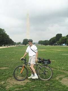
Aug 2 - Ready to roll from Washington Monument |
Monday Aug 2: This first day would only cover about 20 towpath miles, but I would end up biking about 65 miles total. This is because I would be doing a variation of The Fletcher Loop, starting from Lake Needwood. My wife and I actually started off together, heading down the Rock Creek Trail. Once we reached Bethesda, I had to leave my wife at her job. I then continued down the Capital Crescent Trail all the way down to the National Mall (using this no-stress bike route).
I stopped at the Smithonian Metro stop, where I traded photos with a young couple from India. Since this was a workday for everyone else, I decided to do a bit more re-con work for my DC bike commuter map before heading off. So after "playing" in rush hour traffic for about an hour, I headed back over to the river to actually begin the official part of the ride. By this point, I had probably already biked at least 25 miles before I actually got on the towpath.
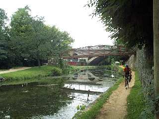
Mile 1: Narrow passing on the berm side. |
The first mile of the towpath begins as a red-brick path, but after four blocks it becomes a very narrow dirt path. This first mile through Georgetown is also the only section where the towpath is on the "berm" side of the canal. I suspect that once the canal ceased operation in 1924, the original towpath on the river side of the canal was gobbled up for other uses. When riding down-river, I believe that many folks miss the cross-over (a metal footbridge), and find themselves stuck at 34th street.
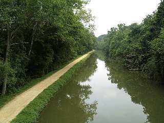
Mile 4 - View from Chain Bridge |
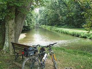
At mile 3, I stopped for a quick snack break at Fletcher's Boathouse. It was really starting to steam up by this point, so the drink break was a nice relief before pushing on upstream. A new gizmo I bought along on this trip was an arm band MP3 player and voice recorder. The device allowed me to taking truly fascinating (grin) notes along the way, which I later used to update the website point-of-interest listings. This led to the second greatest danger I faced during the trip: Trying to NOT look like some idiot talking to himself! So, I would sneak audionotes only when no one was looking (grin).
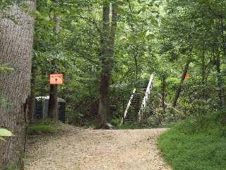
Mile 12: Avoid these stairs - Use parking lot off to right |
Because I was taking detailed notes on this trip, I was especially interested in checking out all the various access points along the way. This resulted in my discovery of the great access point at mile 8.4, (Lock 8). Here, a tunnel takes you under the Clara Barton Parkway and right into downtown Cabin John, MD. There is a small shopping center just a quarter mile inland from the canal (by way of 79th street). Here, I ate lunch at the deli.
The next 12 miles along the towpath is my typical route with the volunteer C&O Bike Patrol, so trudged along without haste. One tip I would like to pass along is about the detour at mile 12. Assuming you don't miss the detour (most people do), the signs would lead you to believe that you must haul you bike up a steep flight of stairs. Instead, head through the parking lot to the right, going up the hill. At the top of the hill make a u-turn onto the Berma Road, which puts you right on the detour route. If you are going the other direction, simply keep going past the stairs until you come to the end of the Berma Road, then make a u-turn head back down the hill to the towpath. However, these tips may soon be obsolete. After 30+ years, repair work is scheduled to begin in Winter 2005 to finally fix this short section of towpath. Hopefully, the work will be done by late-fall 2005.
Mile 20: Relaxing at Pennyfield Lock |
The towpath portion of this day's ride ended at mile 19.7, Pennyfield Lock. The day had now become brutally hot, but I still had over 10 miles to go in order to get back to my car at Lake Needwood (over open roads - no shade). So I took a quick break at Pennyfield before the long steep climb out of the Potomac Valley. With the exception of Travilah Road, the route back to Lake Needwood is pretty much bicycle friendly. Travilah Road is not much fun since it is narrow and winding and lacks shoulders. However, the traffic is typically light on this section so it is manageable. On hot days like this one, I usually stop at the mini-mart on Travilah Road to reload after the hard climb out of the valley.
The ride back to the car was uneventful. My route was basically Dufief Mill, Route 28 (both of which have bike lanes, Gude Drive, and then Southlawn Lane. This got me back to the Rock Creek trail, with a short ride back to the car at the Lake Needwood trailhead. I loaded the car back up and headed back to my home in Montgomery Village, where I spent my first overnight.