Difficulty: III
Bikes:
ATB Only
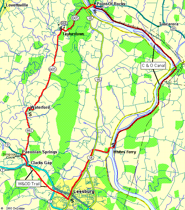
Waterford Double-Cross
| Miles: 34 Difficulty: III Bikes: ATB Only |
Waterford Double-Cross |
|
|
Connecting Routes Trails Used |
|
CAUTION: About 3.5 Miles uses Loose Gravel Surface. ATBs Only This is a combination of routes 18 and 39 from Chuck & Gail's book. This route crosses both the Potomac River and a mountain range twice, but surprisingly the terrain is not too tough. About half the route is paved and half is dirt/gravel, so I wouldn't recommend skinny tires. The trail goes through some nice little towns (like Waterford) and offers some great views of the surrounding valley. There is little traffic to contend with on this route, except for the portions along Route 15 (I strongly suggest that you use the gravel shoulder here!). About 12 Miles are on the C&O Towpath and 5 Miles are on the W&OD Trail. Make sure you have $1.00 for the ferry crossing (Cars are $3.00).
|