Difficulty: III
Bikes:
ATB, Hybrid
Shenandoah River Ramble

| Miles: 27 Difficulty: III Bikes: ATB, Hybrid |
Shenandoah River Ramble |
|
|
Related Routes Other Sites |
An excellent route suggested by Steve Kuehm of Berryville, VA!
This little corner of Virginia is a cyclist's true paradise. The lightly traveled country roads pass the scenic farms, vineyards, and estates of the Shenandoah Valley. It is a bit of a haul from the DC area (about 70 miles), but it is worth the drive. This splendid ride is along the Shenandoah River in Clarke County, VA. A couple of killer hills, but primarily a scenic ride.
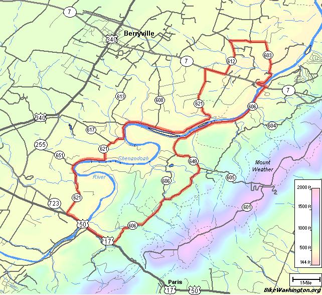
Map of Route |
|
Print: Cue Sheet
GPS: Download (Help) |
To reach the start from the DC Area, head out the Dulles Toll Road / Greenway toward Leesburg. At the end of the Greenway, follow signs to Route 7 West. Continue on Route 7 passing Round Hill and Bluemont. The start is on the other side of the mountain from Bluemont, VA.